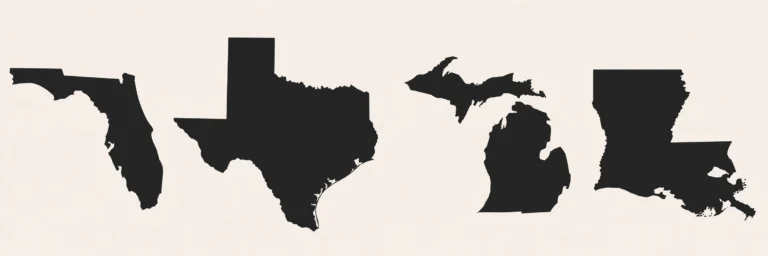
Southern States Quiz Belt: Texas to Florida, All 16 States
When Americans talk about “the South,” they usually mean a feeling: warm weather, sweet tea, drawling accents, and Friday-night football. But on a map, the South is something much more precise. The Census Bureau divides the country into regions, and its South region holds sixteen states, stretching all the way from Delaware on the Atlantic coast down to Florida, and west across the Gulf Coast to Texas. That is a huge belt of land, and it holds more people than any other region in America — about 133 million, according to Census Bureau estimates from July 2025. If you can name all sixteen states, their capitals, and their biggest cities, you have mastered one of the hardest chunks of the United States map, because this region is full of traps. Ten of its sixteen capitals are not the largest city in their state, two different states both have a famous city called Charleston, and the biggest state in the region used to be its own independent country.
The Sixteen States of the Southern Belt
The southern belt runs from the Atlantic to the Rio Grande. On the East Coast, it starts with Delaware, Maryland, and Virginia, then runs down through North Carolina, South Carolina, Georgia, and Florida. Inland, it includes West Virginia, Kentucky, Tennessee, Mississippi, Alabama, Arkansas, and Louisiana. And in the west, it finishes with Oklahoma and Texas. That is sixteen states in total. One thing to get straight right away: Washington, DC sits inside the Census South region on paper, but it is not a state, so it is never counted as a seventeenth state in this group. If a quiz asks how many states are in the South, the answer is sixteen, not seventeen.
The states are wildly different in size. Texas is the most populous southern state, with about 31.7 million people, ahead of Florida at about 23.5 million. Delaware, at the other end, has just over one million people. Between those extremes sit big, fast-growing states like Georgia, North Carolina, and Virginia, each with roughly nine to eleven million residents. Altogether, the sixteen states add up to 133,140,338 people. That number matters because it explains why the South dominates American politics, music, and sports: more than a third of the country lives in this belt.
The Capital Trap: Ten States Where the Capital Is Not the Biggest City
Here is the single best reason to practise the south states quiz. In ten of the sixteen southern states, the capital city is not the largest city. That is a trap that catches almost everyone, because most people naturally guess the biggest, most famous city when they are asked for a capital, and it is why the south states quiz leans so hard on capitals. In Delaware, the capital is Dover, but the largest city is Wilmington. In Maryland, the capital is Annapolis, but Baltimore is far bigger. In Virginia, the capital is Richmond, but Virginia Beach is the largest city. The same pattern repeats in North Carolina (Raleigh versus Charlotte), South Carolina (Columbia versus Charleston), Florida (Tallahassee versus Jacksonville), Kentucky (Frankfort versus Louisville), Alabama (Montgomery versus Huntsville), Louisiana (Baton Rouge versus New Orleans), and Texas (Austin versus Houston).
The six states where the capital and the largest city are the same place are easier to remember: West Virginia (Charleston), Georgia (Atlanta), Tennessee (Nashville), Mississippi (Jackson), Arkansas (Little Rock), and Oklahoma (Oklahoma City). A good study trick is to learn those six first, because they are the safe answers, and then drill the ten traps one by one. The most common mistake of all is guessing the famous city instead of the quiet capital. Nobody forgets New Orleans or Houston, but far fewer people remember Frankfort or Tallahassee, and that is exactly why quiz writers love asking about them.
Two Charlestons, Two Completely Different Answers
Few map facts cause as much confusion as Charleston. There are two famous Charlestons in the South, and they play opposite roles. Charleston, West Virginia is both the capital and the largest city of West Virginia. Charleston, South Carolina is only the largest city of South Carolina — its capital is Columbia. So if a question asks for the capital of South Carolina and you answer Charleston, you are wrong, even though Charleston is the city everyone has heard of. And if a question asks for the largest city in West Virginia, Charleston is right twice over.
The same kind of confusion applies to the two Carolinas as a pair. South Carolina was admitted to the Union first, on 23 May 1788, as the eighth state, while North Carolina followed on 21 November 1789 as the twelfth state. North Carolina is roughly twice as populous as South Carolina — about 11.2 million people compared with about 5.6 million. Their capitals are Raleigh (North Carolina) and Columbia (South Carolina), and their largest cities are Charlotte and Charleston. Learn the pair together and the confusion disappears: South is first in admission, North is bigger in population, and neither capital is the city you would first guess.
Texas, West Virginia, and the Stories Behind the Map
The southern belt is not just a list of names; every border has a story, and the stories make the map stick. Texas is the most dramatic example. It declared independence from Mexico on 2 March 1836 and existed for nearly a decade as the independent Republic of Texas, with its own president, flag, and army, before joining the United States on 29 December 1845 as the twenty-eighth state. That is why Texas still calls itself the Lone Star State, and why its state pride runs deeper than anywhere else in the country.
West Virginia has the opposite story: it was born by splitting away. When Virginia joined the Confederacy in 1861, the western counties, which were loyal to the Union, set up their own government in Wheeling, and West Virginia was admitted as a separate state on 20 June 1863, as the thirty-fifth state. So West Virginia and Virginia share a name and a long border, but they were created by a break, not by a family resemblance. Remembering that split also explains why West Virginia is called the Mountain State while Virginia is the Old Dominion — they were never really twins.
Two more southern facts are worth locking in. Alabama’s largest city is Huntsville, not Birmingham. Older books and tables still say Birmingham, but recent Census estimates put Huntsville ahead, so any source from before 2021 will steer you wrong. And South Carolina grew faster than any other state in percentage terms in the year to July 2025, at 1.46 percent, while Texas added the most people in raw numbers, more than 391,000 in a single year. The South is not just big; it is still growing fast.
How to Memorise the Whole Belt
The easiest way to learn sixteen states is to break them into three groups. First, the Atlantic coast, running south: Delaware, Maryland, Virginia, North Carolina, South Carolina, Georgia, Florida. Second, the inland and Gulf group: West Virginia, Kentucky, Tennessee, Mississippi, Alabama, Arkansas, Louisiana. Third, the western edge: Oklahoma and Texas. Walk the map in that order a few times and the belt starts to feel like one journey instead of sixteen separate facts.
Then add the capitals in the same order, and say the trap pairs out loud: Dover, not Wilmington; Annapolis, not Baltimore; Richmond, not Virginia Beach; Raleigh, not Charlotte; Columbia, not Charleston; Tallahassee, not Jacksonville; Frankfort, not Louisville; Montgomery, not Huntsville; Baton Rouge, not New Orleans; Austin, not Houston. Saying the wrong answer next to the right one is the fastest way to stop mixing them up, because your brain remembers the contrast. Finish with the six safe states — Charleston, Atlanta, Nashville, Jackson, Little Rock, Oklahoma City — and you have the whole belt, which is exactly what the south states quiz tests, state by state.
| State | Capital | Largest city |
|---|---|---|
| Delaware | Dover | Wilmington |
| Maryland | Annapolis | Baltimore |
| Virginia | Richmond | Virginia Beach |
| West Virginia | Charleston | Charleston |
| North Carolina | Raleigh | Charlotte |
| South Carolina | Columbia | Charleston |
| Georgia | Atlanta | Atlanta |
| Florida | Tallahassee | Jacksonville |
| Kentucky | Frankfort | Louisville |
| Tennessee | Nashville | Nashville |
| Mississippi | Jackson | Jackson |
| Alabama | Montgomery | Huntsville |
| Arkansas | Little Rock | Little Rock |
| Louisiana | Baton Rouge | New Orleans |
| Oklahoma | Oklahoma City | Oklahoma City |
| Texas | Austin | Houston |
Frequently Asked Questions
How many states are in the South?
Sixteen. The Census South region includes Delaware, Maryland, Virginia, West Virginia, North Carolina, South Carolina, Georgia, Florida, Kentucky, Tennessee, Mississippi, Alabama, Arkansas, Louisiana, Oklahoma, and Texas.
Is Washington, DC a southern state?
No. Washington, DC sits inside the Census South region, but it is a federal district, not a state, so it is never counted as a seventeenth southern state.
What is the largest state in the South by population?
Texas, with about 31.7 million people according to Census Bureau estimates from July 2025, ahead of Florida at about 23.5 million.
Why do so many southern capitals differ from the largest city?
Many southern capitals were chosen for central locations or political compromise when the states were young, while the largest cities grew later around ports, trade, and industry.
What is the capital of South Carolina?
Columbia. Charleston is South Carolina’s largest city, but Columbia is its capital, which is one of the most common map-quiz traps in America.
Once you can walk the belt from Delaware to Texas without hesitating, and name the capital trap in each state without guessing the famous city, the whole southern map clicks into place. The best way to prove it is to test yourself on the real map, and the us states quiz hub is where the full set of regional quizzes lives.