Tricky State Pairs Everyone Mixes Up (And How to Tell Them Apart for Good)
Intro
You probably know more states than you think. The problem is rarely the whole map. It is the pairs. Two states sit side by side, share a name or a border, and your brain files them under one blurry label. Then on a blank map, or in a quiz, or in a classroom, you point at the wrong one and feel like you knew nothing at all.
That is normal, and it is fixable. Confusion pairs are predictable. The same few states trip up almost everyone, for the same few reasons: similar names, similar shapes, or a shared history that split one place into two. Once you learn the one detail that separates each pair, the mix-up usually stops for good.
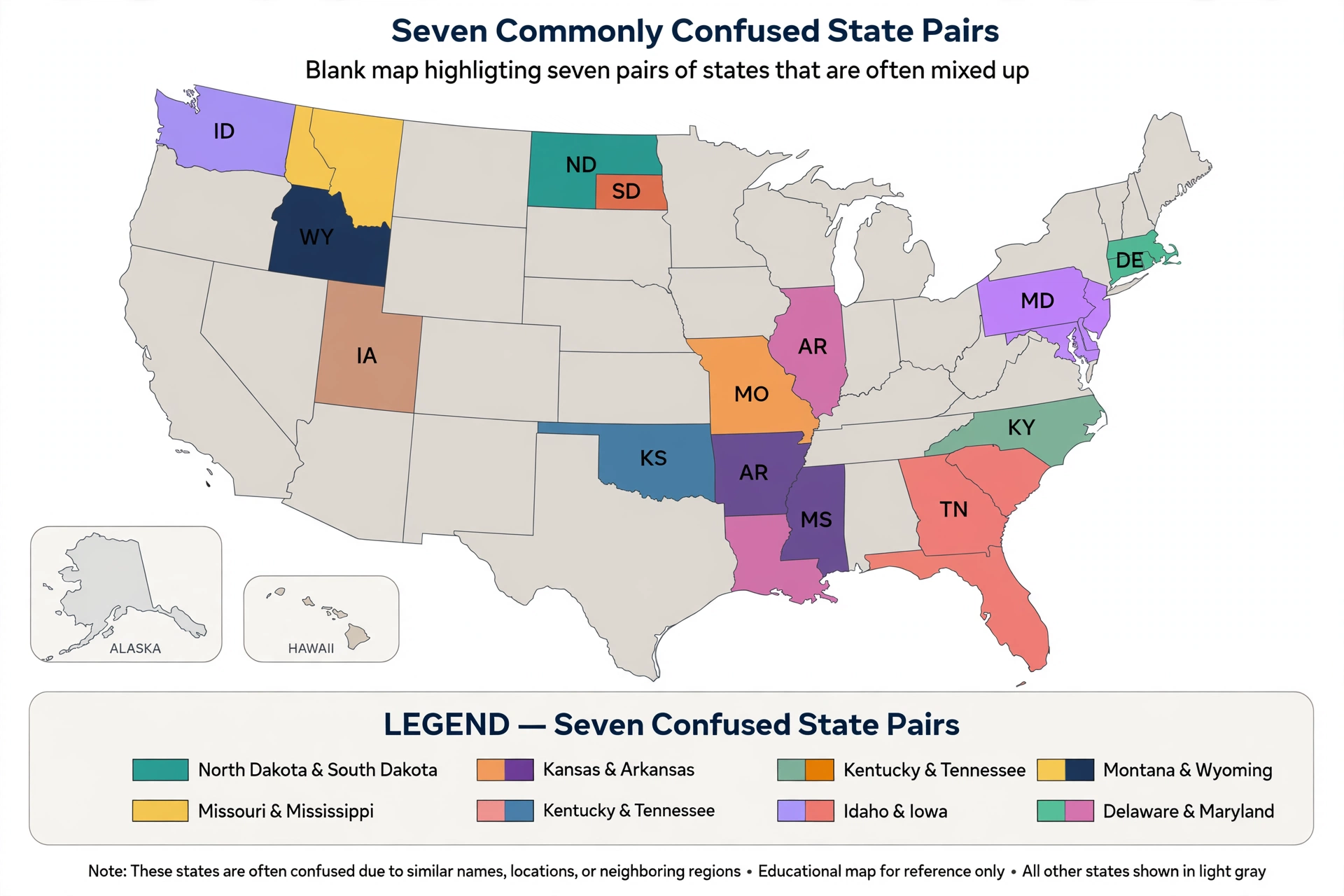
This guide covers seven of the most mixed-up pairs in American geography. For each one you will get the shape clue, the landmark clue, the capitals, and a short memory trick you can actually use under time pressure. At the end there is a five minute practice routine that turns these tricks into lasting recall.
Why Your Brain Mixes Up Pairs
Your brain loves shortcuts. When two things look alike, it stores one rough image instead of two sharp ones. That is efficient for everyday life and terrible for a map quiz.
Three things make a pair hard:
- Shared names. North and South Dakota, North and South Carolina, Virginia and West Virginia. The shared word does half the remembering for you, and then the direction word gets lost.
- Shared borders. Neighbors blend together, especially in the Northeast, where the states are small and the borders follow rivers instead of straight lines.
- Shared stories. Some pairs used to be one place. Virginia and West Virginia were one state until 1863. The Dakotas were one territory until 1889. If you only learn the modern map, the split feels random.
The fix is to stop memorizing lists and start memorizing differences. For every pair below, pick one difference and make it yours. Shape works best for most people, landmarks work best for travelers, and capitals work best for test takers. Use whichever sticks.
Pair 1: Vermont and New Hampshire
Where they sit
These two sit in the far Northeast, side by side under Maine and above Massachusetts. Vermont is on the west. New Hampshire is on the east, touching the Atlantic.
What gives them away
Look at the shapes first. Vermont is wider at the top and narrower at the bottom, roughly like a V. New Hampshire is the mirror image: narrower at the top and wider at the bottom. They share a long border along the Connecticut River.
Then check the water. Vermont is landlocked, with Lake Champlain on its western edge and the Green Mountains running down its middle. New Hampshire has a coastline, but it is tiny, only about 18 miles, the shortest coastline of any coastal state. If the state on the map touches the ocean at all, even for a short stretch, it is New Hampshire.
The capitals help too. Vermont’s capital is Montpelier, the smallest state capital in the country, with roughly 8,000 residents. New Hampshire’s capital is Concord.
Memory trick: V for Vermont, and V for the shape that is wide at the top. The other one, the one that reaches the sea, is New Hampshire. No coast, no New Hampshire.
Pair 2: North Dakota and South Dakota
Where they sit
The Dakotas sit in the upper middle of the country, stacked one on top of the other. North Dakota touches Canada. South Dakota sits below it, above Nebraska.
What gives them away
The eastern halves of the two states look and feel similar: flat farmland, prairie, and small towns along the same north-south highway corridor. The difference is in the west.
Western South Dakota gets dramatic. The Black Hills rise out of the plains in the southwest corner, and the Badlands carve up the land just east of them. Mount Rushmore is in South Dakota, in the Black Hills. North Dakota stays prairie all the way across, with Theodore Roosevelt National Park in its western badlands and wide fields of sunflowers and wheat.
The capitals are a second check. North Dakota’s capital is Bismarck, in the south-central part of the state. South Dakota’s capital is Pierre, pronounced “peer,” on the Missouri River.
Memory trick: Rushmore is in the south. If you picture four presidents carved into a mountain, you are picturing South Dakota, never North Dakota. Canada touches North Dakota, and mountains and monuments mark South Dakota.
Pair 3: North Carolina and South Carolina
Where they sit
The Carolinas sit on the Southeast coast, with North Carolina above South Carolina and Virginia above that. North Carolina is the bigger of the two and stretches much further west into the mountains.
What gives them away
Start at the coast. North Carolina has the Outer Banks, a long, thin chain of barrier islands that sticks far out into the Atlantic, with a sharp bend at Cape Hatteras. South Carolina’s coast is flatter and marshier, the Lowcountry, with the long arc of beach around Myrtle Beach known as the Grand Strand.
Then look west. North Carolina holds the tallest mountains in the East. Mount Mitchell stands at 6,684 feet, the highest point east of the Mississippi River. South Carolina’s mountains are a thin strip along its northwestern edge, and its highest point, Sassafras Mountain, is 3,553 feet, barely half as tall.
The capitals finish the job. North Carolina’s capital is Raleigh, in the central part of the state, in the Research Triangle region with Durham and Chapel Hill nearby. South Carolina’s capital is Columbia, in the center of the state.
Memory trick: The state with the skinny islands reaching into the ocean and the tallest eastern mountain is North Carolina. The state with the marshy Lowcountry coast and the Grand Strand is South Carolina. Banks and height point north; marsh and strand point south.

Pair 4: Virginia and West Virginia
Where they sit
Virginia is on the East Coast, with the Chesapeake Bay cutting deep into it and the Atlantic on its eastern edge. West Virginia sits inland, to Virginia’s west and northwest, landlocked and mountainous.
What gives them away
This pair is confusing because they were once one state. Virginia was much larger, reaching all the way to the Ohio River. During the Civil War, the mountainous western counties did not want to secede from the Union, so they broke away and formed West Virginia in 1863. The border between them today follows the ridges of the Allegheny and Appalachian mountains, which is why it looks so jagged instead of straight.
Virginia still touches the ocean. It has Virginia Beach, the Chesapeake Bay, and even a separate Eastern Shore across the bay, reached by a long bridge and tunnel. West Virginia touches no ocean at all, and its shape is dominated by mountains and two narrow panhandles, one reaching north and one reaching east.
The capitals are distinct. Virginia’s capital is Richmond, on the James River in the eastern part of the state. West Virginia’s capital is Charleston, on the Kanawha River in the western part of the state.
Memory trick: If it touches the sea, it is Virginia. If it is all mountains and no coast, it is West Virginia. The “West” in the name is literal: West Virginia is the western piece that broke away.
Pair 5: Washington State and Washington, DC
Where they sit
This is the only pair on this list that is not two neighboring states, and that is exactly why it confuses people. Washington State is on the far West Coast, in the Pacific Northwest, bordered by Canada, Idaho, Oregon, and the Pacific Ocean. Washington, DC is on the East Coast, on the Potomac River between Maryland and Virginia, about 2,700 miles away.
What gives them away
First, Washington, DC is not a state at all. DC stands for District of Columbia, a federal district created as the national capital in 1790. It covers only about 68 square miles and has roughly 700,000 residents. Washington State became a state much later, in 1889, covers about 71,300 square miles, and has roughly 7.7 million residents.
Second, the cities are different. Washington State’s capital is Olympia, and its largest city is Seattle, home to the tech industry and the rainy, forested Pacific Northwest. Washington, DC is itself the city, home to the White House, the Capitol, and the Supreme Court.
In writing, the abbreviations settle it instantly: WA means the state, DC means the district.
Memory trick: Coast first, then letters. West Coast plus WA equals the state. East Coast plus DC equals the capital district. If someone says they are “going to Washington” without another word, ask which coast before you book anything.
Pair 6: Arizona and New Mexico
Where they sit
Arizona and New Mexico sit side by side in the Southwest, below Utah and Colorado and above Mexico. Arizona is on the west, New Mexico on the east, and they meet Utah and Colorado at a single point called Four Corners, the only place in the country where four states touch.
What gives them away
Their shared border is a straight north-south line, so shape alone will not save you. Use position and landscape instead. Arizona is the southwestern corner of the Four Corners cross, and New Mexico is the southeastern corner. If you are standing at Four Corners, Arizona is to your southwest and New Mexico to your southeast.
The deserts differ too. Arizona is home to the Sonoran Desert and its famous saguaro cacti, tall plants with raised arms, plus the Grand Canyon in the north. New Mexico leans toward the Chihuahuan Desert, with more sagebrush and wide, high plains, and its landscape rises higher: Santa Fe sits at about 7,000 feet, while Phoenix sits at about 1,000 feet.
The capitals are a clean split. Arizona’s capital is Phoenix, a large desert city in the south-central part of the state. New Mexico’s capital is Santa Fe, a smaller, high-elevation city in the north-central part of the state, and one of the oldest capitals in the country.
Memory trick: Cactus arms point west to Arizona. High, dry, and older-feeling Santa Fe points east to New Mexico. At Four Corners, remember the cross: Utah top left, Colorado top right, Arizona bottom left, New Mexico bottom right.
Pair 7: Montana and Wyoming
Where they sit
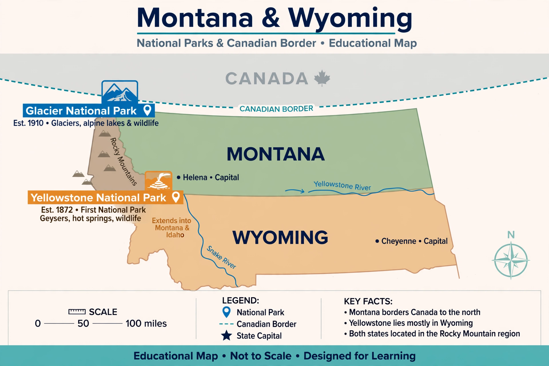
Montana and Wyoming sit in the northern Rocky Mountains, stacked one above the other. Montana is on top, touching Canada. Wyoming is below it, above Colorado and Utah.
What gives them away
Size is the first clue. Montana is the fourth largest state, at about 147,000 square miles, while Wyoming is the tenth largest, at about 97,800 square miles. Montana is roughly half again as big as Wyoming, and it is the only one of the two that touches Canada.
The national parks help as well. Montana holds Glacier National Park in its northwest corner, along the Canadian border, and shares Yellowstone with Wyoming and Idaho. Wyoming holds most of Yellowstone itself, plus Grand Teton National Park just to its south, with its sharp, jagged peaks.
The capitals are easy to keep straight once you link them to position. Montana’s capital is Helena, in the western, mountainous part of the state. Wyoming’s capital is Cheyenne, in the southeastern corner, close to Colorado.
Memory trick: Big on top, smaller below. Montana is bigger and touches Canada. Wyoming is smaller, sits below, and holds the bulk of Yellowstone. If it borders Canada, it cannot be Wyoming.
The 5-Minute Practice Routine
Reading this guide once will not fix the pairs. Practicing them for five minutes a day for a week will. Here is a routine that works:
Minute 1: One pair only. Pick a single pair for the day. Do not study all seven at once. Say both state names, both capitals, and the one difference out loud.
Minutes 2 to 3: Cover and point. Open a blank map, cover the labels, and point to both states. Say the trick as you point. For example: “No coast, so Vermont. Coast, so New Hampshire.”
Minute 4: Flip the question. Instead of naming the state, name the clue. Ask yourself: “Which state has Mount Rushmore?” and “Which capital is Pierre?” Flipping the direction is what stops the mix-up from coming back.
Minute 5: Write it once. Write both state names and both capitals from memory, then check. Writing is slower than reading, and that is the point. The small effort is what makes the memory stick.
After seven days, you will have covered all seven pairs once. On day eight, shuffle them and test yourself on all seven in random order. The pairs that still feel slow are the ones to repeat. Most people find that two or three pairs need a second week, and the rest stay fixed after the first.
Quick Answers to Common Questions
Why do so many states come in north and south pairs?
Because several territories were split in two when they became states. The Dakotas split from Dakota Territory in 1889, and the Carolinas split from the old Carolina colony much earlier, in 1712. The direction word in the name is the only thing that changed, which is why the direction is the easiest thing to forget.
Is Washington, DC a state?
No. It is a federal district, not a state, and it has no voting representation in Congress in the same way states do. That is a common quiz question, and it is also why “Washington” alone is ambiguous.
What is the fastest way to stop mixing up states on a blank map?
Learn one visual anchor per state, not a list of facts. The Outer Banks for North Carolina, Mount Rushmore for South Dakota, the Chesapeake Bay for Virginia, and the Four Corners cross for Arizona and New Mexico are all anchors you can spot in a second. Facts fill in the details later, but the anchor is what gets you the right state first.
Final Check: Test Yourself Before You Move On
Cover the pair sections above and answer these seven questions from memory:
- Which twin has the coastline, Vermont or New Hampshire?
- Which Dakota holds Mount Rushmore?
- Which Carolina has the Outer Banks?
- Which Virginia touches the ocean?
- Which Washington is a state, and which is a federal district?
- At Four Corners, which state is the southeastern corner?
- Which of Montana and Wyoming touches Canada?
If you got all seven, the pairs are yours. If one or two slipped, go back to that pair’s trick only, not the whole article. That is how you fix a mix-up instead of restudying everything.
For a timed check, try the free map quiz linked below. A blank map with a timer is the fastest way to find out which pairs still need work, because it removes the clues this article just gave you and asks your memory to do the job alone. Take the challenge on the us states quiz site and see how many of these seven pairs you can place correctly on the first try.